
When you want to measure the area of your backyard or the length of the lake next to your property, we usually use the conventional taps and measure gadgets. However, to make your life easy, Google recently introduced the feature to measure the area or perimeter of land with Google Map app. There is no need to use any tools to measure the distance or area of the land; you just need your Android/iPhone with Google Map. This workaround can be used with your desktop by opening Google Maps on your desktop browser.
The same feature will also work with the Google Earth app, and you can measure the distance between continents, countries, or the length of your local street, pretty amazing!.
Measure the Distance with Google Map on Desktop
Google map will work pretty well with the Chrome browser on the desktop. To measure the distance, you have to open the Google Map on the browser and type the address or location where you want to measure.
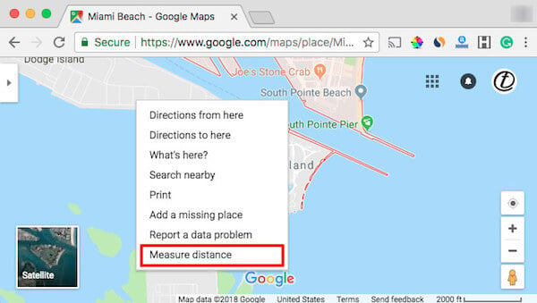
Once you find on the location you want to measure, right-click on the Google map and select “Measure Distance.” Now click on the map location, and your first click will register as the starting point of the location you want to measure.
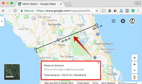
The line will follow until you click on the second spot and that will consider as the distance you want to measure. Google Map will display the distance between the two points that clicked on the Map. In the above sample screenshot, we measured the width of Florida, which came as 103 miles approximately.
Measure the Area with Google Map on Desktop
When you want to treat your yard or get a quote from yard maintenance guys, you need an approximate idea of your yard area. You can do a quick calculation of the yard area with Google Map.
To start, you have to locate the point on Google Map and right-click on the Google Map. Click on the map to mark the starting point. Now you can click on the border of the land you want to measure until you reach the starting point. Now Google will calculate the polygon that you made on the map with mouse clicks.
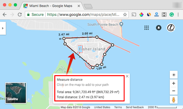
We have used a sample to measure the Fisher Island area with Google Map, and we got an approximate area of nine million square feet. Please be aware that this is an approximate calculation. The accuracy can be improved by zooming the map and selecting the points to surround by the property.
Google Tool can Project Sunlight & Solar Panel Area on your Roof.
Measure the Area/Distance with Google Map on Android/iPhone
You can measure the area or the distance of the land by using your Google Map on Android or iPhone. The same procedure that we mentioned on top is applicable to the Google Map App. However, since this is a dedicated app, there are slight changes in the menu.
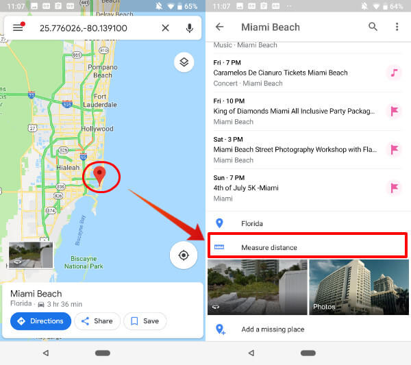
To go ahead, you have to open the Google Map app on the Mobile phone and long tap on the location you want to set as the starting point. Now you can drag the map and tap on the second point where you want to measure.
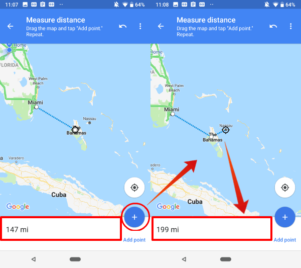
We used the Google map app to measure the distance between Miami and the Bahamas and Google Map displays around 147 miles. You can keep moving on the Google Map app to select the next point or circulate with taps to measure the area of a property.
How to Share your Location without a Street Address or City?
Measure the Distance/Area with Google Earth
Google Earth introduced the same feature a while ago. This virtual measure tool will work on Android or Google Chrome with Google Earth. On Google Earth, you can measure the area of the county or distance between two regions Just mark the starting point and endpoints with two mouse clicks. Google will tell you the distance between them.
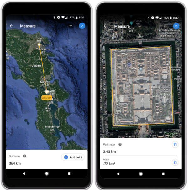
You can measure the area and perimeter or a region or property with Google Earth. As you see the second screen, with few taps, you can mark a rectangle and Google Earth will display the marked area perimeter and Area instantly. Pretty neat and quick solution to measure the distance.
How to Use Google Maps to Find Vegan and Gluten-Free Restaurants Anywhere
Google rolled out the virtual tape on Google Map and Google Earth that can be used to measure the distance perimeter or the area of land with few taps right from your Mobile phone or desktop. Even though this measurement is not highly accurate, still a good measure for those who want to get an approximate measurement of a property area or the distance between two spots on a region.